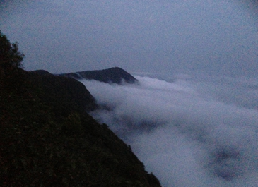
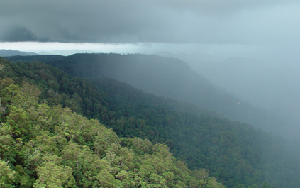
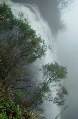
Hydroecology It’s all about water! Water is the key to survival of Springbrook’s World Heritage values. It is at the heart of why this area is a refugium for such an incredible number of ancient lineages of plants, animals and members of other Kingdoms of living creatures. Many of these species have very conservative physiological or morphological traits that limit their tolerance to stressful environmental conditions. They survive mostly in areas that still resemble those in which they evolved many millions of years ago when conditions were much wetter and equable than now. Protection, conservation or restoration of those special conditions is the basis of Springbrook Rescue, so that all future generations are able to appreciate and be inspired by this area of outstanding universal value. It’s all about systems! Everything is connected! Everything is important! Terrestrial and aquatic systems are strongly connected ecologically across the broader landscape. Immersion in clouds is common in the high country contributing very significantly, through cloud stripping by intact forests, to biologically available water. Fractured basalts store water and slowly release in springs and soaks. Permanently wet environments near waterfalls are biologically unique. We need to understand these water flows in order to effectively restore this World Heritage to its former ‘aliveness’.
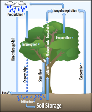
Traditional hydrology simply deals with water storage and flows to and from surface and groundwater stores. However, the water cycle is tightly linked to other biogeochemical processes (including nutrient cycles) and the climate (energy) system, which are fundamental to life on earth and critical to resilient ecosystem functioning. To be more relevant to understanding the functional relationships and feedbacks between water cycles, energy and the living parts of the environment, hydrology and ecology are linked in the relatively new fields of “hydroecology” or “ecohydrology” depending on the emphasis. An “ecohydrological” approach reveals how hydrological processes influence the distribution, structure, function and dynamics of biological communities; and how feedbacks (both positive and negative) from biological communities affect the water cycle. Plants must have water to grow through fixing carbon from the atmosphere using the energy of sunlight. Photosynthesis however incurs a water cost – when leaf stomata (tiny pores) open for CO2 to enter, water is simultaneously lost. This transpiration (akin to plants “sweating”) loses, on average, 180 molecules of water as water vapour for each molecule of CO2 acquired. Rainforests are thus giant cloud-making ‘machines’ generating at the same time a radiation shield protecting the forest environment from overheating. In water-limited environments the ability to reduce this loss (its water-use efficiency) will determine the plant’s fitness to survive in such habitats. Plants that evolved in water-rich environments did not or could not adapt and need the environmental buffers that refugia provide as well as help from other “nurse” plants to complete their life cycle and continue to survive. This understanding is critical to successful restoration. Global warming may impact Springbrook’s refugium in many ways. The condensation point for cloud formation is controlled by air temperature. Warmer temperatures are likely to elevate the cloud base that used to keep the forests moist, cool and sheltered from intense solar radiation. Species that thrived in these cool cloudy mountaintops may no longer survive. No plants or animals can live without water in some form or another. How much water is biologically available or needed by primary producers (plants) or consumers (animals) in terrestrial ecosystems depends on a complex number of factors. What factors are important for the health of aquatic systems? What are the important linkages between terrestrial and aquatic systems? What are the priorities for achieving landscape connectivity across both terrestrial and aquatic systems? Understanding these various factors is fundamental to successful restoration. Our research projects are directed to this end. We have taken a catchment-approach to all our restoration and research activities.
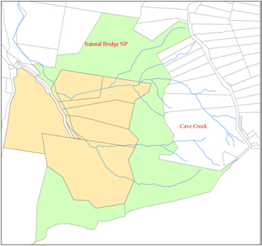
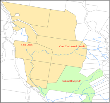
The Springbrook plateau (above ~600 m) comprises 10 subcatchments of the Nerang River and Little Nerang Creek (both East and West branches). These subcatchments vary in size between 20 and 290 hectares each, as well as in altitude, topographic diversity, aspect, radiation and rainfall regimes, soils and geological substrates.
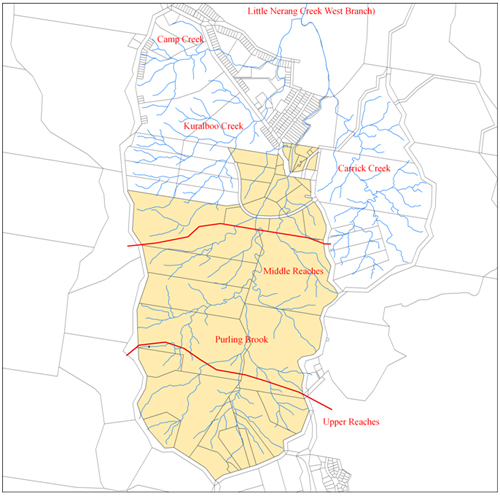
Our Restoration activities on the lower plateau are restricted to two properties in the upper upper reaches of Purling Brook. Local conservationists are working with land owners at restoring Camp and Kuralboo catchments.
Effects of land-use on hydrology Currently, there are no controls on clearing within the Village areas on Springbrook under Queensland’s laws. Schedule 24 of the Sustainable Planning Regulation 2009 exempts tree-clearing in the two Springbrook village areas from assessment under the Vegetation Management Act 1999 (VMA 1999) even though the Canyon Village, in particular, contains rare old-growth Eucalyptus oreades forest replete with tree hollows for hollow-dependent fauna. There are also currently no controls on groundwater extraction for either domestic or commercial use on the Springbrook Plateau even though ground water is a critical component of biogeochemical cycles upon which transmission of the World Heritage to all future generations depends.
|
|||||||||||||||||
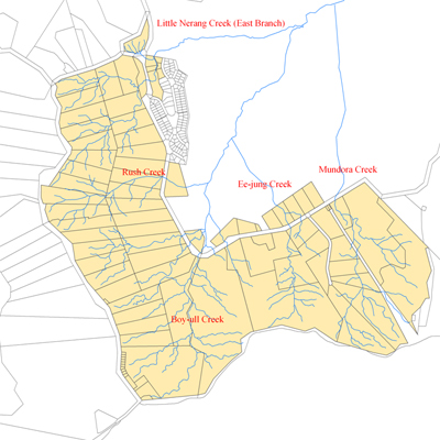 High plateau catchments digitized by Aila Keto (ARCS) using ArcGIS