| Home | The Vision | Springbrook — A Natural Wonder | The Springbrook Rescue Project | Support the Project | About ARCS |
Menu
Geology The area represents the northern flank of the now extinct Tweed Shield Volcano, active between about 23 and 20 Million years ago. The caldera is the best preserved of its kind and size in the world. Five major eruption episodes of varying intensities and durations produced as many lava flows differing in composition, density, areal extent and depth. The oldest and most extensive flows (Beechmont Basalts) range in thickness from 300 m to 150 m, south to north. The two succeeding basalt flows are interleaved by harder, less erodible rhyolites (Binna Burra Rhyolite and Springbrook Rhyolite), with Hobwee Basalts the last overtopping layer restricted to the highest, southernmost parts of the plateau. Springbrook Rhyolite forms the upper cliff line of this plateau. 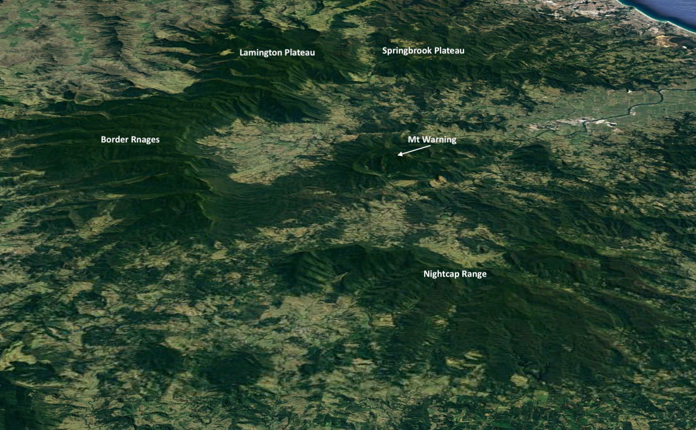
Google Earth image showing the remnant elements of the Mt Warning caldera 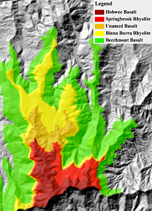 This image was produced by Aila Keto and Keith Scott by digitising geological mapping by Wilmott and Hayne (2001) and layering over a digital terrain model generously donated by Gold Coast City Council. Rock types affect landscape erosion and hence landform evolution. The lithology of geological substrates exerts major controls on nutrient status of the soil parent material (regolith) and the actual soil profile. Meso-scale (landscape) spatial variability in soil parent material determines vegetation structures, life forms and plant physiognomy through effects of nutrient availability on plant productivity. Moisture and thermal regimes affect nutrient availability by influencing rates of bedrock weathering and soil water pH. Basalts are highly variable in composition depending on the rates of cooling, the amount of dissolved gases and interval between successive flows. Rocks from gassy lavas are perforated by holes that enhance weathering. Generally basaltic magmas erupt at temperatures of 1100–1300 °C from deep within the earth, and so are rich in iron and magnesium and low in silica, producing dark to black rocks. The fertile, basic basaltic soils with their high clay content are particularly vulnerable to compaction from trampling and heavy machinery, even at low usage levels, with potentially irreparable biophysical damage affecting prospects of restoring close to original ecosystems (Talbot et al. 2003). Rhyolite lavas crystallise at lower temperatures (900–1000 °C) to produce pale-coloured (grey to yellow), very fine-grained or glassy rocks with very little iron and magnesium but high levels of quartz (up to 70 per cent) and aluminium reflecting their origins from the melting of continental crust. These explosively extruded, viscous lavas cooled rapidly producing slow-flowing thick layers of acidic, relatively erosion-resistant rocks. Rhyolite weathers slowly forming acidic, thin, infertile soils that can only support simpler rainforests, eucalypt forests or heaths. The lower cliff lines typically around Purling Brook Falls are of Binna Burra Rhyolite which is thickest at the northern end of the plateau. The upper cliff lines at the southern end of the plateau along the border and around Twin Falls are of Springbrook Rhyolite. These are best viewed from Best-of-All Lookout or the Canyon Lookout. Talbot, L.M., Turton, S.M. and Graham, A.W. (2003). Journal of Environmental Management 69 (1), 63–69. Wilmott, W.F. and Hayne, M. (2001). Slope stability and its constraints on closer settlement, Springbrook Plateau and Upper Tallebudgera and Currumbin Valleys, south-east Queensland. Dept of Mines and Energy, Brisbane 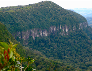
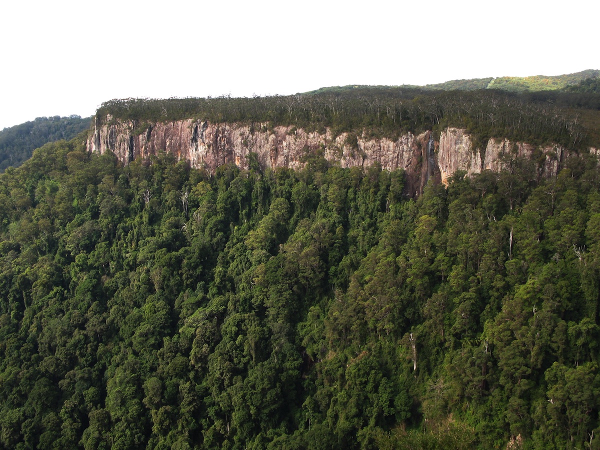 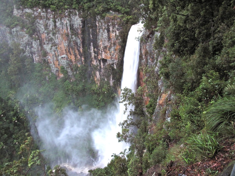
Left to right: rhyolite clifflines at the southern end of the plateau, from Canyon Lookout and northern end of the plateau, Purlingbrook Falls. |