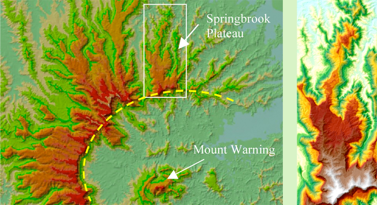
Springbrook lies on the northern flanks of the Tweed Volcano which, with its well-developed radial drainage, is easily recognizable as a shield volcano, despite its age (23.5–20.5 million years). Erosion has left a core, Mt Warning, isolated from a horseshoe-shaped arc of precipitous cliffs — the Mt Warning or Tweed Caldera. This erosion caldera, about 30 km across, is one of the major examples of this landform in the world, notable for its size and central mountain mass.
The Springbook precinct is effectively a biogeographic island isolated by fluvial processes typically associated with volcanic landforms, preserving extremely compressed environmental gradients (climatic, hydrological, physiographic, historical) including the wettest, most nutrient rich environments nationally outside its sister area, the Wet Tropics.
Altitudinal gradients encompass lowlands (less than 400 m), through uplands (400–800 m) to highlands (800–1051 m). Each altitudinal zone shows further segmentation of microenvironments on the basis of altitude, geology, rainfall and aspect — these are the key present-day determinants of plant and animal distributions, abundances and movements since they determine availability of energy, moisture, nutrients, the essential factors for life.
The highest points in the area are Mt Mumdjin (1010 m) in the south-west corner of the plateau and Mt Bilbrough (960 m) 2 km to the east along the McPherson Range. The lower limit of the plateau’s elevation gradient was set at ~600 m, as this generally marks the transition between the flatter topography of the plateau and the near vertical, rhyolite-derived cliff faces