| Home | The Vision | Springbrook — A Natural Wonder | The Springbrook Rescue Project | Support the Project | About ARCS |
|
The Science | |||||||
| |||||||
|
Science Projects
| |||||||
|
ARCS Photo Monitoring Project ‘Repeat photography’ is a technique for monitoring or detecting changes in the landscape by comparing photographs of the same place or areas over time (Pickard 2002). The scale can vary from landscape (100 m – several kilometers) using time-series aerial photography, to sites (10–100 m) and microsites (<1m) using on-ground photopoint monitoring from a fixed location. Both techniques provide valuable information depending on the purpose of the monitoring. | |||||||
 |
|||||||
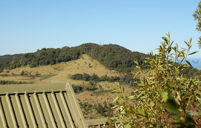
Mt Springbrook taken one year after the property was purchased by the Queensland Government on 27/10/2005. Photo: WJMcD 30/7/2006 |
|||||||
 |
|||||||
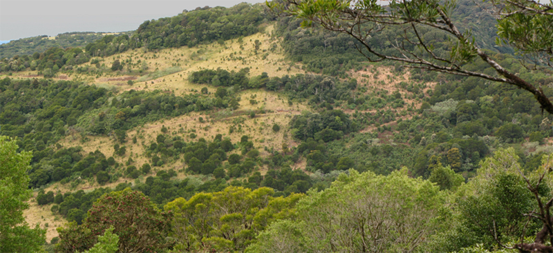
Mt Springbrook – the west slopes are filling in well: Photo: Aila Keto |
|||||||
|
We are using a range of techniques, including both on-ground photography (A) and aerial photography (B), to meet different objectives. A. On-ground photography Its limitations, on the other hand, are that it detects only what is discernable from the position of the camera, can only be semi-quantitative at best, is silent on causation, and any strict monitoring schedule may be disrupted by adverse weather conditions. Accepting these limitations, we believe photopoint monitoring at sites can provide a useful adjunct to other more quantitative approaches for monitoring the progress of assisted natural regeneration. Our photopoint monitoring objectives are limited and restricted to obtaining visual measures or records of: | |||||||
|
|||||||
|
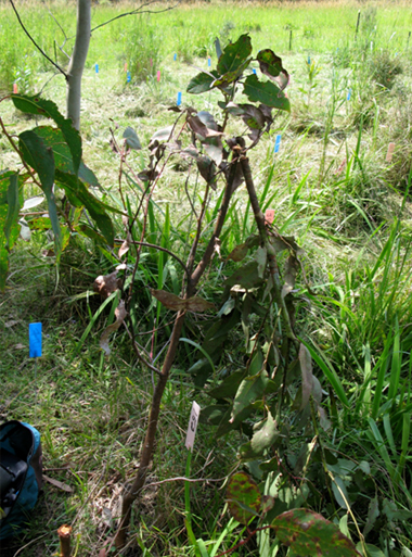
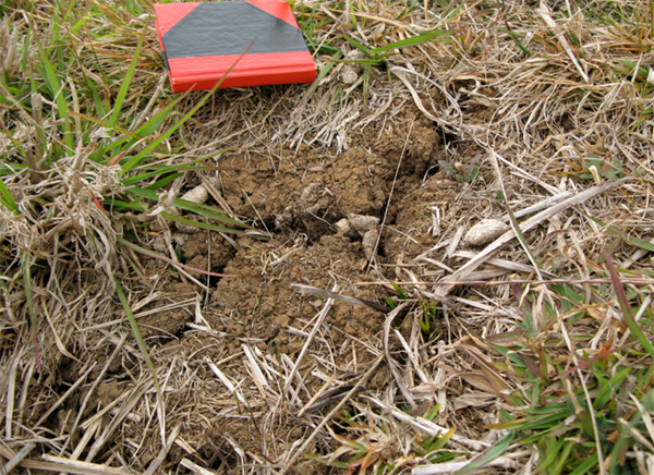
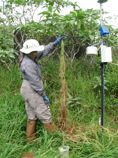
Basic Methods Materials consisted of star pickets and droppers, 50m tape measure, aluminium tags and soft-tie-wire or cattle tags, GPS and camera. A camera post for the camera position and two Sighter Posts mark the fixed line of sight for viewing. The distance between the camera post and first sighter post is 5–10 m, and the two sighter posts are separated by 15–35m depending on the vegetation type being monitored. The camera is held steady at eye level using a tripod and the field of view fixed by the base of the first sighter post. Results from all photopoints are documented in standardized reports Supplementary photos are taken of features of interest relating to the objectives at each photomonitoring site, e.g. cracking of basalt soil during lengthy dry periods, windthrow of unprotected trees, frost damage to plants, impact of herbivory, rare species of interest etc. |
|||||||
 |
|||||||
An example of supplementary photographs of cracking soils during prolonged dry periods. Photo: Aila Keto |
|||||||
 |
|||||||
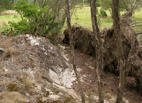
An example of uprooting of canopy trees that grow on rock pavements by heavy winds during or after prolonged drought. The isolated nature of this remnant of montane heath vegetation makes it vulnerable due to the lack of microclimate buffering of adjacent trees. Photo: Aila Keto |
|||||||
 |
 |
 |
|||||
|
|||||||
 |
|||||||
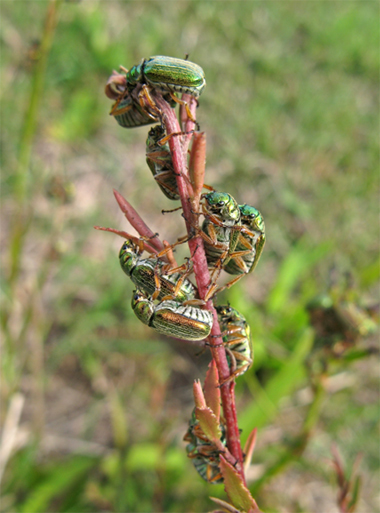
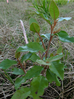
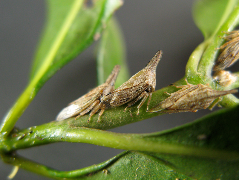
Lantana Leaf Hoppers found on non-target species (Polyosma cunninghamii). Photo: Aila Keto |
|||||||
 |
|||||||
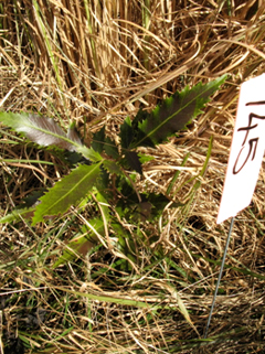
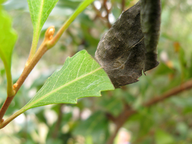
Example of leaf-cutting herbivory on Lomatia arborescens which can result in a reduction in photosynthetic leaf area of up to 50 per cent or more. Photo Aila Keto |
|||||||
| |||||||
 |
|||||||
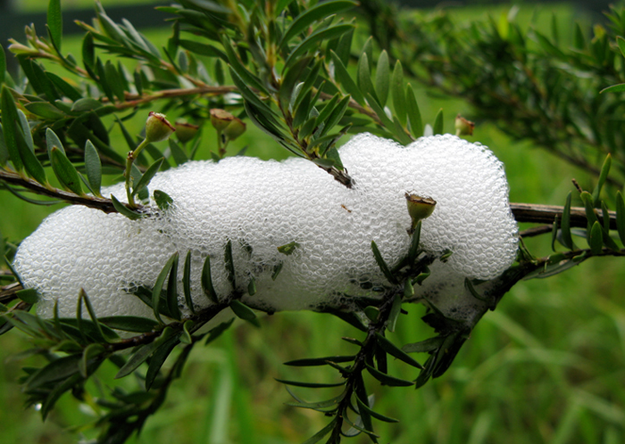
Spittle Bug infestations can kill young leptospermum plants by blocking phloem flow. Photo: Aila Keto |
|||||||
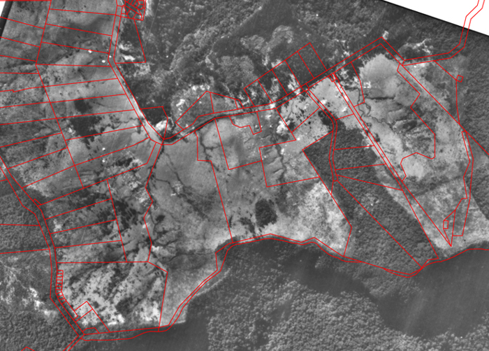
B. Aerial Repeat Photography However, time-series aerial photography and photopoint monitoring complement each other in providing a useful record of the results of ecological restoration. For determining the age of regeneration on various sites, historical air-photo records over 68 years (1930, 1961, 1975, 1989, 1993, 1998) were purchased, scanned and rectified. High-resolution digital records for 2005 were obtained pro bono from the Gold Coast City council as part of a data-sharing arrangement under their program of support for not-for-profit organisations. Cleared areas were digitized and mapped as polygons using ArcGIS. Monitoring of recovery of land cover in these areas post-2005 is quantified using a GIS-based point grid system with either Google Earth or NearMap imagery. |
|||||||
 |
|||||||
A rectified, geo-referenced image of clearing in the high country in 1930. |
|||||||
Data Management References Pickard, J. (2002). Assessing vegetation change over a century using repeat photography. Australian Journal of Botany 50(4), 400-414. Pupo-Correia, A., Aranha, J.T. and de Sequeira, M.M. (2011). Photographs from tourist activity: a source to assess vegetation change using repeat landscape photography. Journal of Tourism and Sustainability 1(1), 13-17. Webb, R.H., Boyer, D.E. and Turner, R.M. Eds. (2010). Repeat Photography: Methods and applications in the Natural Sciences. Island Press. Wheatbelt Natural Resource Management (2010). Land Manager Monitoring Guide. |
|||||||